Hiking Bob -- The trek to Lost Lake makes a perfect July hike

Lost Lake is lost no more.
Back in 2017, when I first hiked to Lost Lake, high up Cottonwood Pass west of Buena Vista, it was a "if you know, you know" destination. There was no officially marked trailhead, parking was at an unmarked pull-out on the road and there was not much of a trail - in fact you had to make your way through a section that was somewhat like a swamp. It wasn't a trail you'd just stumble upon, and with no other trails nearby and the lake's somewhat secluded location, you could have been wandering around fairly close to it and not even know a lake was there.
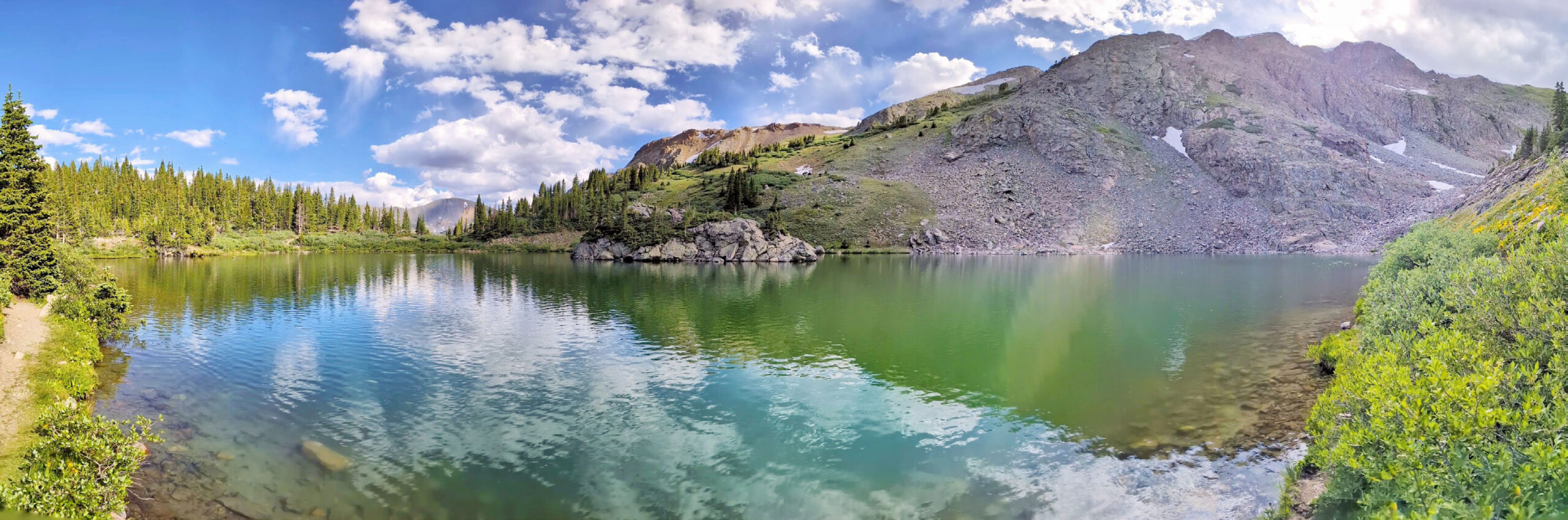
The pay-off, however, if you did manage to get to it, was that Lost Lake is a beautiful blue-green alpine lake at just a few feet below 12,000' in elevation, three-quarters of which is surrounded by steep mountains, and it even has a small island in the middle.
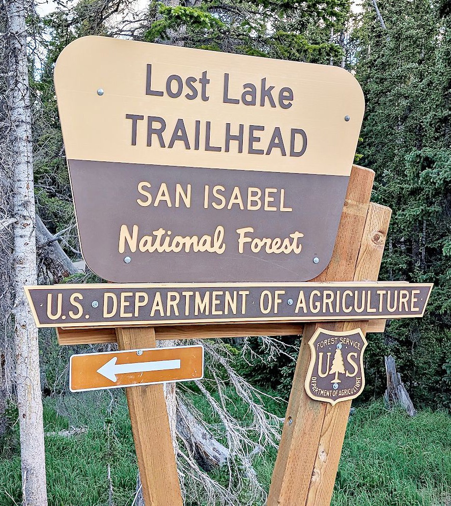
Within the last couple of years, the U.S. Forest Service built an official, large trailhead and parking area, along with a new route to the lake, about half of which uses an old two-track road and about half is a new single-track trail. The trail is easy to follow, with only a single, well signed turn to make off the old road. There are interpretive signs at points of interest along the way, and the new route is not only completely different from the old route, but according to a comparison of my GPS tracks from 2017 and from my hike there a few weeks ago, the new route is roughly a mile shorter than the old. Win-Win!
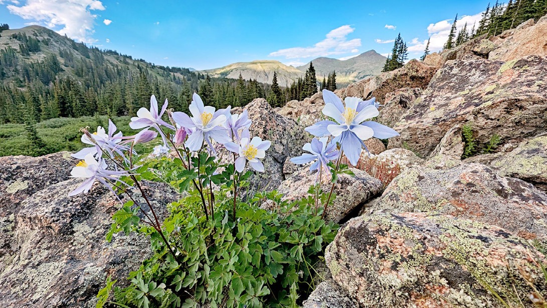
That's not to say that Lost Lake Trail #1532 isn't without challenges. The trail, at about 3.75 miles round trip, goes from an elevation of more than 11,500' to just under 12,000' at the lake, so it may not be suitable for people who are not acclimated or have difficulty coping at this elevation. Some parts of the trail - mostly in the last third of a mile before the lake - are on rocky, fist-sized, ankle-twisting talus, so hiking poles are recommended. And finally, due to its elevation, visitors early in the spring may still encounter a lot of snow on the trail. My suggestion is to hike this trail in July, when the snow will be gone and wildflowers are out in abundance.
As always, be aware of wildlife. After my recent hike there, I learned later that a bull moose wandered into the lake area shortly after I left, and an adult moose and a moose calf were also spotted near the trailhead. Because of moose activity, consider leaving your pooch at home, since they are known to be aggressive to dogs, leashed or otherwise. At the very least, keep Fido leashed while on the trail. Be bear aware, too.
Also, keep an eye on the weather, as it can change suddenly at that elevation.
The trail is open to foot and equestrian traffic only. Bikes, e-bikes and motorized vehicles are prohibited. This trail is not yet shown on the COTREX app or website.
To get there: From Buena Vista, the well-marked trailhead is about 100' past mile marker two on Cottonwood Pass Road (County Road 306), on the left side of the road. If you make it to the summit of Cottonwood Pass, you went too far. The trailhead is on a tight turn, so use caution when turning across the road. On my visit, two portable toilets were available. There is no water available, so bring plenty. Cottonwood Pass Road is closed over the winter, making this trail virtually inaccessible. There is no cell phone service at the trailhead or on the trail.
Be Good. Do Good Things. Leave No Trace.